
92242 topographic map
Interactive map
Click on the map to display elevation.
About this map
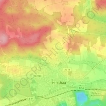
Name: 92242 topographic map, elevation, terrain.
Average elevation: 430 m
Minimum elevation: 351 m
Maximum elevation: 484 m
Other topographic maps
Click on a map to view its topography, its elevation and its terrain.
Ehenfeld
Deutschland > Bayern > Landkreis Amberg-Sulzbach > Hirschau
Ehenfeld, Hirschau, Landkreis Amberg-Sulzbach, Bayern, 92242, Deutschland
Average elevation: 478 m
Massenricht
Deutschland > Bayern > Landkreis Amberg-Sulzbach > Hirschau
Massenricht, Hirschau, Landkreis Amberg-Sulzbach, Bayern, 92242, Deutschland
Average elevation: 477 m