
Thank you for supporting this site ❤️
Make a donation
Make a donation
Sumberejo topographic map
Click on the map to display elevation.
Thank you for supporting this site ❤️
Make a donation
Make a donation
About this map
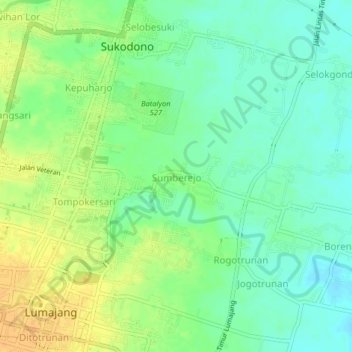
Name: Sumberejo topographic map, elevation, terrain.
Location: Sumberejo, Lumajang, East Java, Java, 67313, Indonesia (-8.13992 113.21885 -8.09992 113.25885)
Average elevation: 44 m
Minimum elevation: 31 m
Maximum elevation: 61 m
Thank you for supporting this site ❤️
Make a donation
Make a donation