
Thank you for supporting this site ❤️
Make a donation
Make a donation
Ironton topographic map
Click on the map to display elevation.
Thank you for supporting this site ❤️
Make a donation
Make a donation
About this map
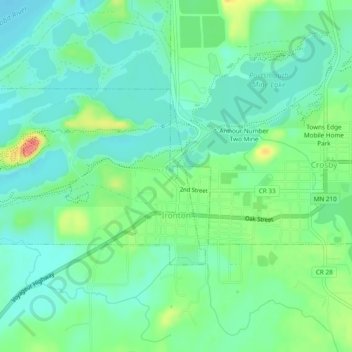
Name: Ironton topographic map, elevation, terrain.
Location: Ironton, Crow Wing County, Minnesota, United States (46.47285 -94.02067 46.48936 -93.97308)
Average elevation: 378 m
Minimum elevation: 360 m
Maximum elevation: 420 m
Thank you for supporting this site ❤️
Make a donation
Make a donation
Other topographic maps
Click on a map to view its topography, its elevation and its terrain.
Middle Cullen Lake
United States > Minnesota > Crow Wing County > Pequot Lakes
Average elevation: 372 m
Thank you for supporting this site ❤️
Make a donation
Make a donation