
Make a donation
Valladolid topographic map
Click on the map to display elevation.
Make a donation
Valladolid
Valladolid is located at roughly 735 metres above sea level, at the centre of the Meseta Norte, the plateau drained by the Duero river basin covering a major part of the Northwest of the Iberian Peninsula. The primitive urban core was built ex novo in the 11th century on a small elevation near the confluence of the Esgueva with the Pisuerga, on the left-bank of the latter river. The city of Valladolid currently lies on both banks of the Pisuerga, a major right-bank tributary of the Douro.
Make a donation
About this map
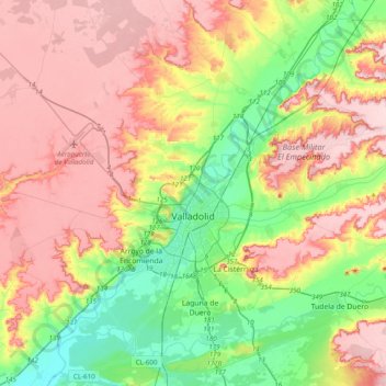
Name: Valladolid topographic map, elevation, terrain.
Location: Valladolid, Castile and León, Spain (41.52313 -4.92818 41.81551 -4.63081)
Average elevation: 768 m
Minimum elevation: 672 m
Maximum elevation: 868 m
Make a donation
Other topographic maps
Click on a map to view its topography, its elevation and its terrain.