
Thank you for supporting this site ❤️
Make a donation
Make a donation
Lea topographic map
Click on the map to display elevation.
Thank you for supporting this site ❤️
Make a donation
Make a donation
About this map
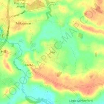
Name: Lea topographic map, elevation, terrain.
Location: Lea, Wiltshire, England, SN16 9FE, United Kingdom (51.55759 -2.08159 51.59759 -2.04159)
Average elevation: 82 m
Minimum elevation: 61 m
Maximum elevation: 102 m
Thank you for supporting this site ❤️
Make a donation
Make a donation
Other topographic maps
Click on a map to view its topography, its elevation and its terrain.
Thank you for supporting this site ❤️
Make a donation
Make a donation
Thank you for supporting this site ❤️
Make a donation
Make a donation