
Make a donation
Chino Hills topographic map
Click on the map to display elevation.
Make a donation
Chino Hills
Due to its topography of rolling hills, Chino Hills was primarily rural prior to the mid-1970s; most land was utilized for equestrian purposes and for dairies, except for the multi-use purposes of the State of California, promoting jobs for the community through day labor from the Chino Institute for Men on Central Avenue. Rapid and extensive housing developments followed throughout the 1980s and early 1990s, only slowing down in recent years. Most neighborhoods are arranged in a village-type format with strategically placed shopping centers and parks designed to be within walking distance of nearby homes.
Make a donation
About this map
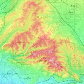
Name: Chino Hills topographic map, elevation, terrain.
Average elevation: 255 m
Minimum elevation: 75 m
Maximum elevation: 533 m
Make a donation
Other topographic maps
Click on a map to view its topography, its elevation and its terrain.