
Thank you for supporting this site ❤️
Make a donation
Make a donation
Kandeman topographic map
Click on the map to display elevation.
Thank you for supporting this site ❤️
Make a donation
Make a donation
About this map
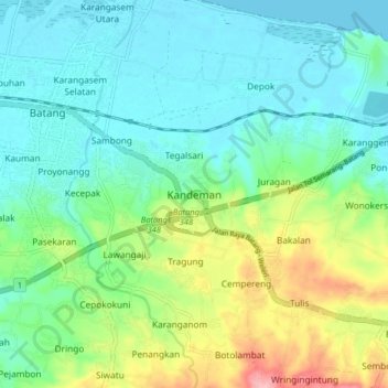
Name: Kandeman topographic map, elevation, terrain.
Location: Kandeman, Batang, Central Java, Java, 51261, Indonesia (-6.96484 109.72084 -6.88484 109.80084)
Average elevation: 37 m
Minimum elevation: 0 m
Maximum elevation: 135 m
Thank you for supporting this site ❤️
Make a donation
Make a donation
Other topographic maps
Click on a map to view its topography, its elevation and its terrain.