
Thank you for supporting this site ❤️
Make a donation
Make a donation
Auburn topographic map
Click on the map to display elevation.
Thank you for supporting this site ❤️
Make a donation
Make a donation
About this map
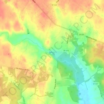
Name: Auburn topographic map, elevation, terrain.
Location: Auburn, Fauquier County, Virginia, 20139, United States (38.68290 -77.72083 38.72290 -77.68083)
Average elevation: 110 m
Minimum elevation: 76 m
Maximum elevation: 134 m
Thank you for supporting this site ❤️
Make a donation
Make a donation
Other topographic maps
Click on a map to view its topography, its elevation and its terrain.
Thank you for supporting this site ❤️
Make a donation
Make a donation
C.F. Phelps Wildlife Management Area
United States > Virginia > Fauquier County
Average elevation: 95 m
Thank you for supporting this site ❤️
Make a donation
Make a donation