
Make a donation
Big Pine topographic map
Click on the map to display elevation.
Make a donation
Big Pine
Big Pine (formerly Bigpine) is a census-designated place (CDP) in Inyo County, California, United States. Big Pine is located approximately 15 miles (24 km) south-southeast of Bishop, at an elevation of 3,989 feet (1,216 m). The population was 1,756 at the 2010 census, up from 1,350 at the 2000 census. The Big Pine Band of Owens Valley Paiute Shoshone Indians of the Big Pine Reservation operates their tribal headquarters from here.
Make a donation
About this map
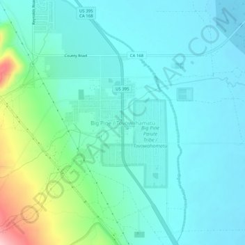
Name: Big Pine topographic map, elevation, terrain.
Location: Big Pine, Inyo County, California, 92513, United States (37.14242 -118.30943 37.18242 -118.26943)
Average elevation: 1,232 m
Minimum elevation: 1,193 m
Maximum elevation: 1,390 m
Make a donation
Other topographic maps
Click on a map to view its topography, its elevation and its terrain.
Make a donation
Cartago
United States > California > Inyo County
Cartago (Spanish for "Carthage") is a census-designated place in Inyo County, California, United States. Cartago is located on the west side of Owens Lake 3 miles (4.8 km) north-northwest of Olancha, at an elevation of 3629 feet (1106 m). The population was 92 at the 2010 census, down from 109 at the 2000…
Average elevation: 1,152 m
Darwin
United States > California > Inyo County
Darwin is an unincorporated mining community in Inyo County, California, United States. It is located 22 miles (35 km) southeast of Keeler, at an elevation of 4,790 ft (1,460 m). The population was 43 at the 2010 census, down from 54 at the 2000 census.
Average elevation: 1,484 m
Make a donation
Round Valley
United States > California > Inyo County
Round Valley is a census-designated place (CDP) in Inyo County, California, United States. Round Valley is located 7.5 miles (12 km) northeast of Mount Tom, at an elevation of 4692 feet (1430 m). The population was 435 at the 2010 census, up from 278 at the 2000 census.
Average elevation: 1,491 m
Olancha
United States > California > Inyo County
Olancha (Timbisha: Pakwa' si) is a census designated place in Inyo County of the U.S. state of California. Olancha is located on U.S. Route 395 in California, 37 miles (60 km) south-southeast of Independence, at an elevation of 3658 feet (1115 m). As of the 2010 census, the population was 192, up from 134 at…
Average elevation: 1,200 m
Make a donation