
Thank you for supporting this site ❤️
Make a donation
Make a donation
Nehbandan topographic map
Click on the map to display elevation.
Thank you for supporting this site ❤️
Make a donation
Make a donation
Nehbandan
Nehbandan is located at an altitude of 1196 meters above sea level, and the heights of the north of this city reach 2500 meters above sea level. Nehbandan is located near the central desert of Iran. Precious stones in mines along with agriculture is another reason for the importance of Nehbandan. The people of Nehbandan are Parthians and Aryans who have lived in this area since pre-Islamic times. Nehbandan climate is classified as hot and dry due to its proximity to the central desert of Iran.
Thank you for supporting this site ❤️
Make a donation
Make a donation
About this map
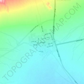
Name: Nehbandan topographic map, elevation, terrain.
Average elevation: 1,209 m
Minimum elevation: 1,164 m
Maximum elevation: 1,400 m
Thank you for supporting this site ❤️
Make a donation
Make a donation