
Thank you for supporting this site ❤️
Make a donation
Make a donation
Val de Castellón topographic map
Click on the map to display elevation.
Thank you for supporting this site ❤️
Make a donation
Make a donation
About this map
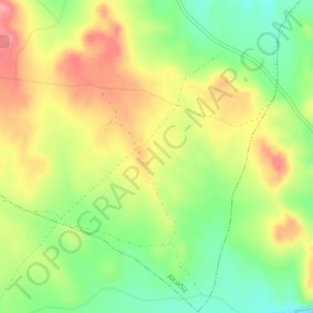
Name: Val de Castellón topographic map, elevation, terrain.
Average elevation: 406 m
Minimum elevation: 359 m
Maximum elevation: 454 m
Thank you for supporting this site ❤️
Make a donation
Make a donation
Other topographic maps
Click on a map to view its topography, its elevation and its terrain.
Salada de la Jabonera de las Torrazas
España > Aragón > Bajo Aragón > Alcañiz
Average elevation: 354 m