Geolocate

Marunji topographic map

Click on the map to display elevation.

About this map
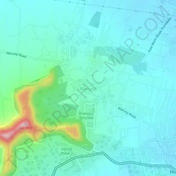
Name: Marunji topographic map, elevation, terrain.

Location: Marunji, Mulshi Subdistrict, Pune District, Maharashtra, 411115, India (18.59167 73.69565 18.63167 73.73565)

Average elevation: 621 m

Minimum elevation: 577 m

Maximum elevation: 831 m

Other topographic maps

Click on a map to view its topography, its elevation and its terrain.

Temghar dam

India > Maharashtra > Mulshi Subdistrict

Average elevation: 745 m

Mulshi Dam

India > Maharashtra > Mulshi Subdistrict > Sambhave

Average elevation: 608 m

Shirgaon

India > Maharashtra > Mulshi Subdistrict

Average elevation: 688 m