
Make a donation
Meskla topographic map
Click on the map to display elevation.
Make a donation
Meskla
Meskla (Μεσκλά) is a village in the municipality of Platanias, a regional unit of Chania, western Crete, in Greece. According to the 2021 census it has 268 inhabitants. It is built on an altitude of 200 meters, at the northern foothills of the White Mountains, in the valley of the river Keritis. It is 21 km away from the city of Chania and 4 km from the village of Fournes. In the past it was a community of the province of Kydonia which included, besides Meskla, the village of Zourva.
Make a donation
About this map
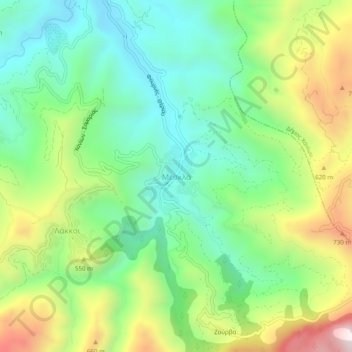
Name: Meskla topographic map, elevation, terrain.
Average elevation: 422 m
Minimum elevation: 126 m
Maximum elevation: 964 m
Make a donation
Other topographic maps
Click on a map to view its topography, its elevation and its terrain.
Municipality of Kantanos-Selinon
Greece > Region of Crete > Chania Regional Unit
Average elevation: 389 m
Make a donation
Make a donation
Municipality of Kantanos-Selinon
Greece > Region of Crete > Chania Regional Unit
Average elevation: 389 m
Make a donation
Make a donation