
Thank you for supporting this site ❤️
Make a donation
Make a donation
Nelson topographic map
Click on the map to display elevation.
Thank you for supporting this site ❤️
Make a donation
Make a donation
About this map
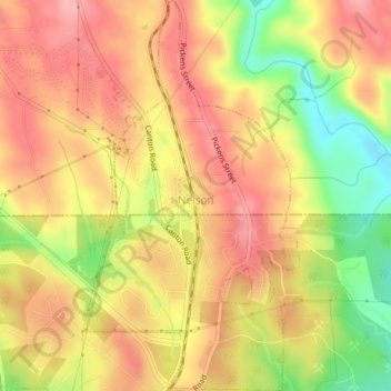
Name: Nelson topographic map, elevation, terrain.
Location: Nelson, Pickens County, Georgia, 30151, United States (34.36606 -84.38222 34.39872 -84.36054)
Average elevation: 374 m
Minimum elevation: 294 m
Maximum elevation: 425 m
Thank you for supporting this site ❤️
Make a donation
Make a donation
Other topographic maps
Click on a map to view its topography, its elevation and its terrain.
Thank you for supporting this site ❤️
Make a donation
Make a donation
Thank you for supporting this site ❤️
Make a donation
Make a donation