
Thank you for supporting this site ❤️
Make a donation
Make a donation
Brimfield topographic map
Click on the map to display elevation.
Thank you for supporting this site ❤️
Make a donation
Make a donation
About this map
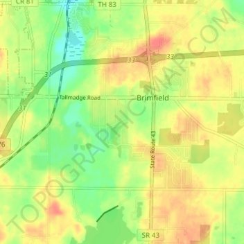
Name: Brimfield topographic map, elevation, terrain.
Average elevation: 340 m
Minimum elevation: 314 m
Maximum elevation: 361 m
Thank you for supporting this site ❤️
Make a donation
Make a donation
Other topographic maps
Click on a map to view its topography, its elevation and its terrain.
Tom S Cooperrider-Kent Bog State Nature Preserve
United States > Ohio > Portage County
Average elevation: 335 m
Thank you for supporting this site ❤️
Make a donation
Make a donation
Nelson Ledges Quarry Park
United States > Ohio > Portage County > Garrettsville
Average elevation: 306 m
Thank you for supporting this site ❤️
Make a donation
Make a donation