
Make a donation
Clarksville topographic map
Click on the map to display elevation.
Make a donation
About this map
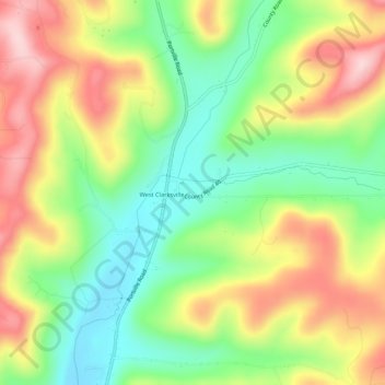
Name: Clarksville topographic map, elevation, terrain.
Average elevation: 574 m
Minimum elevation: 466 m
Maximum elevation: 706 m
Make a donation
Other topographic maps
Click on a map to view its topography, its elevation and its terrain.
Village of Almond
United States > New York > Allegany County > Town of Almond
Average elevation: 469 m
Make a donation
Make a donation
Make a donation
Make a donation
Town of Alfred
United States > New York > Allegany County
There is a small stream known as Canacadea Creek, that flows throughout the year from south to north. This stream flows to the Canisteo River, which is a tributary to the Susquehanna River watershed. The topography is steep hill country as it is part of the Allegheny Plateau, being the northern part of the…
Average elevation: 630 m
Make a donation
Make a donation
Village of Andover
United States > New York > Allegany County > Town of Andover
Average elevation: 561 m