
Thank you for supporting this site ❤️
Make a donation
Make a donation
Bourbon topographic map
Click on the map to display elevation.
Thank you for supporting this site ❤️
Make a donation
Make a donation
About this map
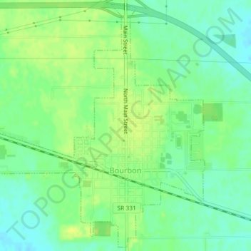
Name: Bourbon topographic map, elevation, terrain.
Location: Bourbon, Marshall County, Indiana, United States (41.28730 -86.13769 41.31345 -86.10501)
Average elevation: 256 m
Minimum elevation: 247 m
Maximum elevation: 264 m
Thank you for supporting this site ❤️
Make a donation
Make a donation
Other topographic maps
Click on a map to view its topography, its elevation and its terrain.