
Flatschach topographic map
Click on the map to display elevation.
About this map
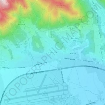
Name: Flatschach topographic map, elevation, terrain.
Location: Flatschach, Spielberg, Bezirk Murtal, Styria, 8720, Austria (47.19848 14.73128 47.23848 14.77128)
Average elevation: 751 m
Minimum elevation: 658 m
Maximum elevation: 1,210 m