
Thank you for supporting this site ❤️
Make a donation
Make a donation
Goveli topographic map
Click on the map to display elevation.
Thank you for supporting this site ❤️
Make a donation
Make a donation
About this map
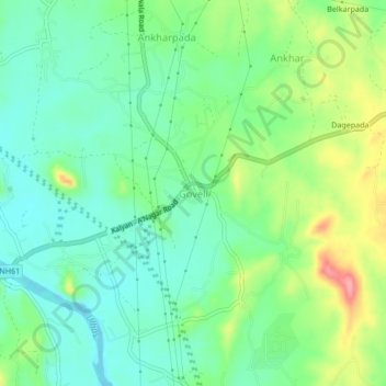
Name: Goveli topographic map, elevation, terrain.
Location: Goveli, Kalyan Taluka, Thane, Maharashtra, 421103, India (19.24249 73.22014 19.28249 73.26014)
Average elevation: 34 m
Minimum elevation: -1 m
Maximum elevation: 104 m
Thank you for supporting this site ❤️
Make a donation
Make a donation
Other topographic maps
Click on a map to view its topography, its elevation and its terrain.