
Thank you for supporting this site ❤️
Make a donation
Make a donation
Davis Island topographic map
Click on the map to display elevation.
Thank you for supporting this site ❤️
Make a donation
Make a donation
About this map
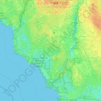
Name: Davis Island topographic map, elevation, terrain.
Location: Davis Island, Dixie County, Florida, United States (29.20273 -83.45013 29.84273 -82.81013)
Average elevation: 8 m
Minimum elevation: -1 m
Maximum elevation: 38 m
Thank you for supporting this site ❤️
Make a donation
Make a donation
Other topographic maps
Click on a map to view its topography, its elevation and its terrain.