
Le Corong topographic map
Interactive map
Click on the map to display elevation.
About this map
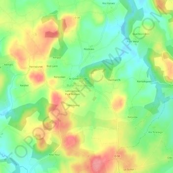
Name: Le Corong topographic map, elevation, terrain.
Average elevation: 259 m
Minimum elevation: 220 m
Maximum elevation: 307 m
Other topographic maps
Click on a map to view its topography, its elevation and its terrain.
Lotissement Park Morvan
France > Brittany > Côtes-d'Armor > Bulat-Pestivien
Lotissement Park Morvan, Bulat-Pestivien, Guingamp, Côtes-d'Armor, Brittany, Metropolitan France, 22160, France
Average elevation: 259 m
Santez Anna
France > Brittany > Côtes-d'Armor > Bulat-Pestivien > Santez Anna
Santez Anna, Bulat-Pestivien, Guingamp, Côtes-d'Armor, Brittany, Metropolitan France, 22160, France
Average elevation: 250 m