
Make a donation
قهی topographic map
Click on the map to display elevation.
Make a donation
About this map
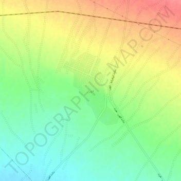
Name: قهی topographic map, elevation, terrain.
Average elevation: 1,581 m
Minimum elevation: 1,549 m
Maximum elevation: 1,618 m
Make a donation
Other topographic maps
Click on a map to view its topography, its elevation and its terrain.
Shahin Shahr
Iran > Isfahan Province > Shahin Shahr and Meymeh County
The city is among the central mountain ranges of Iran to the east of the Zagros Mountains. It has an altitude of 1662 meters on average with a slope of 16%. It has a dry climate with very little precipitation. The variation in temperature is about 50 degrees Celsius.
Average elevation: 1,601 m
Make a donation
Kashan
Iran > Isfahan Province > Kashan County
Kashan has a hot desert climate (BWh) in Köppen climate classification and (BW) in Trewartha climate classification, with cold winters (although warmer than other Iranian cities) and hot, sometimes very hot summers. Kashan is significantly warmer than other cities in the Iranian Plateau due to its lower…
Average elevation: 964 m
Make a donation
دهستان برخوار غربی
Iran > Isfahan Province > Shahin Shahr and Meymeh County
Average elevation: 1,806 m
دهستان قهاب شمالی
Iran > Isfahan Province > Isfahan County > دهستان قهاب شمالی
Average elevation: 1,551 m
Make a donation