
Thank you for supporting this site ❤️
Make a donation
Make a donation
Pine River topographic map
Click on the map to display elevation.
Thank you for supporting this site ❤️
Make a donation
Make a donation
About this map
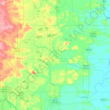
Name: Pine River topographic map, elevation, terrain.
Location: Pine River, Waushara County, Wisconsin, 54976, United States (44.11762 -89.30485 44.21361 -88.90480)
Average elevation: 267 m
Minimum elevation: 226 m
Maximum elevation: 370 m
Thank you for supporting this site ❤️
Make a donation
Make a donation
Other topographic maps
Click on a map to view its topography, its elevation and its terrain.