
Thank you for supporting this site ❤️
Make a donation
Make a donation
Kisesa 'A' topographic map
Click on the map to display elevation.
Thank you for supporting this site ❤️
Make a donation
Make a donation
About this map
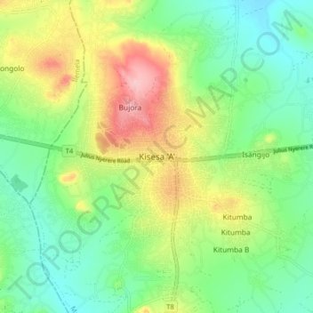
Name: Kisesa 'A' topographic map, elevation, terrain.
Location: Kisesa 'A', Magu, Mwanza Region, Lake Zone, Tanzania (-2.59463 33.00501 -2.51463 33.08501)
Average elevation: 1,235 m
Minimum elevation: 1,171 m
Maximum elevation: 1,347 m
Thank you for supporting this site ❤️
Make a donation
Make a donation
Other topographic maps
Click on a map to view its topography, its elevation and its terrain.