
营根镇 topographic map
Interactive map
Click on the map to display elevation.
About this map
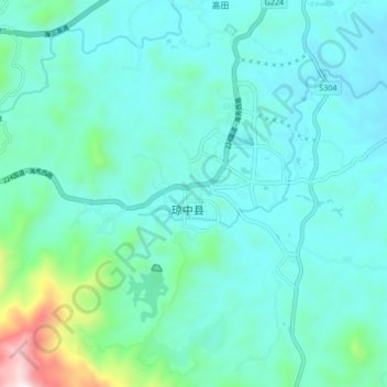
Name: 营根镇 topographic map, elevation, terrain.
Location: 营根镇, 琼中黎族苗族自治县, 海南省, 中国 (18.99706 109.79617 19.07706 109.87617)
Average elevation: 308 m
Minimum elevation: 167 m
Maximum elevation: 1,080 m
Other topographic maps
Click on a map to view its topography, its elevation and its terrain.