
月牙湖乡 topographic map
Interactive map
Click on the map to display elevation.
About this map
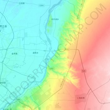
Name: 月牙湖乡 topographic map, elevation, terrain.
Location: 月牙湖乡, 兴庆区, 银川市, 宁夏回族自治区, 中国 (38.31869 106.43709 38.65733 106.65968)
Average elevation: 1,187 m
Minimum elevation: 1,100 m
Maximum elevation: 1,364 m
Other topographic maps
Click on a map to view its topography, its elevation and its terrain.