
Thank you for supporting this site ❤️
Make a donation
Make a donation
Tonggo topographic map
Click on the map to display elevation.
Thank you for supporting this site ❤️
Make a donation
Make a donation
About this map
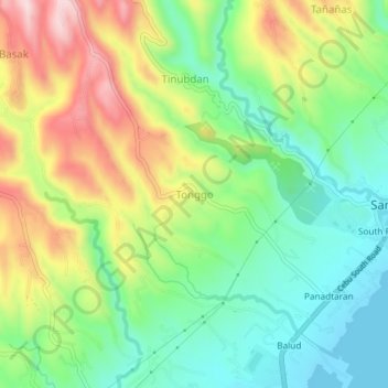
Name: Tonggo topographic map, elevation, terrain.
Location: Tonggo, Cebu, Central Visayas, 6018, Philippines (10.14396 123.66474 10.18396 123.70474)
Average elevation: 142 m
Minimum elevation: 0 m
Maximum elevation: 367 m
Thank you for supporting this site ❤️
Make a donation
Make a donation
Other topographic maps
Click on a map to view its topography, its elevation and its terrain.