Pleasant Hill topographic map
Interactive map
Click on the map to display elevation.
About this map
![Pleasant Hill topographic map, elevation, terrain](/pub/maps/node/62b3/jvs7c5k/thumbnail.jpg)
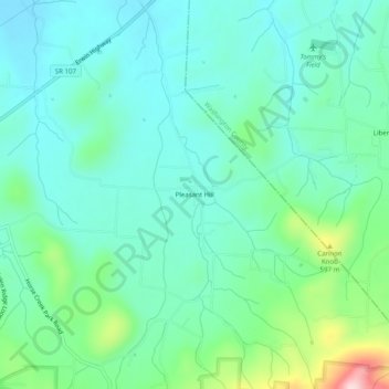
Name: Pleasant Hill topographic map, elevation, terrain.
Location: Pleasant Hill, Greene County, Tennessee, United States (36.11566 -82.66654 36.15566 -82.62654)
Average elevation: 493 m
Minimum elevation: 430 m
Maximum elevation: 710 m
Other topographic maps
Click on a map to view its topography, its elevation and its terrain.
![Highland Hills topographic map, elevation, terrain](/pub/maps/node/wnkl/v89vltj/icon.jpg)
Highland Hills
United States > Tennessee > Greene County > Greeneville
Highland Hills, Greeneville, Greene County, East Tennessee, Tennessee, 37744, United States
Average elevation: 461 m
![Jones Island topographic map, elevation, terrain](/pub/maps/node/gt5k/lh8cntj/icon.jpg)
Jones Island
United States > Tennessee > Greene County
Jones Island, Greene County, East Tennessee, Tennessee, United States
Average elevation: 538 m
![Robinson Forest topographic map, elevation, terrain](/pub/maps/node/7918/hd4ndrr/icon.jpg)
Robinson Forest
United States > Tennessee > Greene County > Greeneville
Robinson Forest, Greeneville, Greene County, East Tennessee, Tennessee, 37745, United States
Average elevation: 472 m
![Greeneville topographic map, elevation, terrain](/pub/maps/relation/fxgp/mvlm2/icon.jpg)
Greeneville
United States > Tennessee > Greene County
Greeneville, Greene County, East Tennessee, Tennessee, 37744, United States
Average elevation: 435 m
![Mosheim topographic map, elevation, terrain](/pub/maps/relation/f2gp/mvbm2/icon.jpg)
Mosheim
United States > Tennessee > Greene County
Mosheim, Greene County, East Tennessee, Tennessee, 37818, United States
Average elevation: 379 m
![Camp Creek topographic map, elevation, terrain](/pub/maps/node/6ds8/v8bdwtj/icon.jpg)
Camp Creek
United States > Tennessee > Greene County
Camp Creek, Greene County, East Tennessee, Tennessee, United States
Average elevation: 443 m
![Liberty Hill topographic map, elevation, terrain](/pub/maps/node/bm5k/65d8w9m/icon.jpg)
Liberty Hill
United States > Tennessee > Greene County
Liberty Hill, Greene County, East Tennessee, Tennessee, 37461, United States
Average elevation: 539 m
![Mohawk topographic map, elevation, terrain](/pub/maps/node/n5tj/s92ffgt/icon.jpg)
Mohawk
United States > Tennessee > Greene County
Mohawk, Greene County, East Tennessee, Tennessee, 37810, United States
Average elevation: 339 m
![Windy Hills topographic map, elevation, terrain](/pub/maps/node/qr5k/jngx45k/icon.jpg)
Windy Hills
United States > Tennessee > Greene County > Greeneville
Windy Hills, Greeneville, Greene County, East Tennessee, Tennessee, 37743, United States
Average elevation: 453 m
![Tusculum topographic map, elevation, terrain](/pub/maps/relation/n23q/q9x5k/icon.jpg)
Tusculum
United States > Tennessee > Greene County
Tusculum, Greene County, Tennessee, United States
Average elevation: 445 m
![Chuckey topographic map, elevation, terrain](/pub/maps/node/xwf3/fghhz1h/icon.jpg)
Chuckey
United States > Tennessee > Greene County
Chuckey, Greene County, East Tennessee, Tennessee, 37641, United States
Average elevation: 460 m
![Walkertown topographic map, elevation, terrain](/pub/maps/node/rltj/xz4b73l/icon.jpg)
Walkertown
United States > Tennessee > Greene County
Walkertown, Greene County, Tennessee, 37616, United States
Average elevation: 496 m
![Holland Mill topographic map, elevation, terrain](/pub/maps/node/gct6/9qc2fzs/icon.jpg)
Holland Mill
United States > Tennessee > Greene County > Holland Mill
Holland Mill, Greene County, Tennessee, United States
Average elevation: 392 m
![Margarette Falls topographic map, elevation, terrain](/pub/maps/node/lc9m/np5jwnh/icon.jpg)
Margarette Falls
United States > Tennessee > Greene County
Margarette Falls, Greene County, Tennessee, United States
Average elevation: 851 m