
Thank you for supporting this site ❤️
Make a donation
Make a donation
Kiryat Ono topographic map
Click on the map to display elevation.
Thank you for supporting this site ❤️
Make a donation
Make a donation
About this map
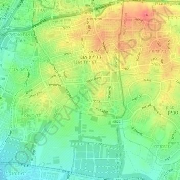
Name: Kiryat Ono topographic map, elevation, terrain.
Location: Kiryat Ono, Tel Aviv Subdistrict, Tel Aviv District, Israel (32.03324 34.83663 32.07106 34.86832)
Average elevation: 58 m
Minimum elevation: 28 m
Maximum elevation: 94 m
Thank you for supporting this site ❤️
Make a donation
Make a donation