
Rotensol topographic map
Interactive map
Click on the map to display elevation.
About this map
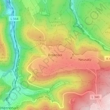
Name: Rotensol topographic map, elevation, terrain.
Average elevation: 485 m
Minimum elevation: 298 m
Maximum elevation: 696 m
Other topographic maps
Click on a map to view its topography, its elevation and its terrain.
Gaistal
Deutschland > Baden-Württemberg > Landkreis Calw > Bad Herrenalb
Gaistal, Herrenalb, Bad Herrenalb, Verwaltungsgemeinschaft Bad Herrenalb, Landkreis Calw, Baden-Württemberg, 76332, Deutschland
Average elevation: 555 m
Neusatz
Deutschland > Baden-Württemberg > Landkreis Calw > Bad Herrenalb
Neusatz, Bad Herrenalb, Verwaltungsgemeinschaft Bad Herrenalb, Landkreis Calw, Baden-Württemberg, 75335, Deutschland
Average elevation: 538 m