
Thank you for supporting this site ❤️
Make a donation
Make a donation
Oud-Heverlee topographic map
Click on the map to display elevation.
Thank you for supporting this site ❤️
Make a donation
Make a donation
About this map
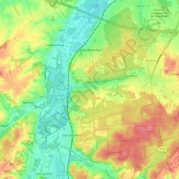
Name: Oud-Heverlee topographic map, elevation, terrain.
Location: Oud-Heverlee, Leuven, Flemish Brabant, Flanders, Belgium (50.79087 4.63211 50.85223 4.74659)
Average elevation: 58 m
Minimum elevation: 16 m
Maximum elevation: 109 m
Thank you for supporting this site ❤️
Make a donation
Make a donation
Other topographic maps
Click on a map to view its topography, its elevation and its terrain.