
Thank you for supporting this site ❤️
Make a donation
Make a donation
Junction topographic map
Click on the map to display elevation.
Thank you for supporting this site ❤️
Make a donation
Make a donation
About this map
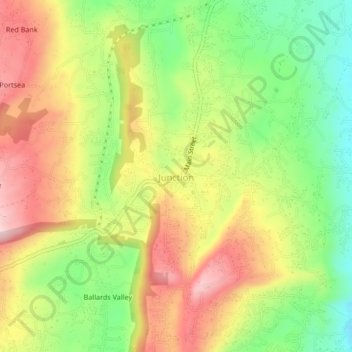
Name: Junction topographic map, elevation, terrain.
Location: Junction, Saint Elizabeth, Cornwall County, Jamaica (17.88632 -77.62819 17.92632 -77.58819)
Average elevation: 352 m
Minimum elevation: 223 m
Maximum elevation: 485 m
Thank you for supporting this site ❤️
Make a donation
Make a donation
Other topographic maps
Click on a map to view its topography, its elevation and its terrain.