
Thank you for supporting this site ❤️
Make a donation
Make a donation
Prauthoy topographic map
Click on the map to display elevation.
Thank you for supporting this site ❤️
Make a donation
Make a donation
About this map
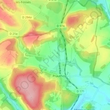
Name: Prauthoy topographic map, elevation, terrain.
Average elevation: 333 m
Minimum elevation: 273 m
Maximum elevation: 411 m
Thank you for supporting this site ❤️
Make a donation
Make a donation
Other topographic maps
Click on a map to view its topography, its elevation and its terrain.
Combe de Vaux
France > Grand Est > Haute-Marne > Le Montsaugeonnais > Couzon-sur-Coulange
Average elevation: 298 m
Thank you for supporting this site ❤️
Make a donation
Make a donation