Rogue River topographic map
Interactive map
Click on the map to display elevation.
About this map
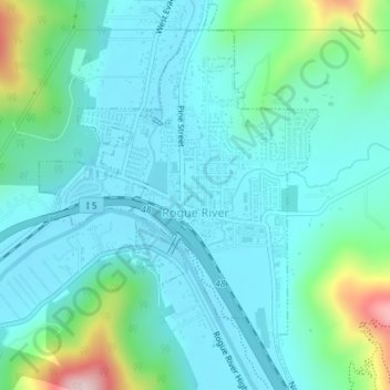
Name: Rogue River topographic map, elevation, terrain.
Location: Rogue River, Jackson County, Oregon, 97537, United States (42.42141 -123.18348 42.44787 -123.15730)
Average elevation: 362 m
Minimum elevation: 295 m
Maximum elevation: 647 m
Other topographic maps
Click on a map to view its topography, its elevation and its terrain.
Ashland
United States > Oregon > Jackson County
Ashland, Jackson County, Oregon, United States
Average elevation: 774 m
Medford
United States > Oregon > Jackson County
Medford, Jackson County, Oregon, United States
Average elevation: 441 m
Trail
United States > Oregon > Jackson County
Trail, Jackson County, Oregon, 97539, United States
Average elevation: 534 m
Ruch
United States > Oregon > Jackson County
Ruch, Jackson County, Oregon, United States
Average elevation: 560 m
Applegate
United States > Oregon > Jackson County
Applegate, Jackson County, Oregon, United States
Average elevation: 501 m
White City
United States > Oregon > Jackson County
White City, Jackson County, Oregon, 97503, United States
Average elevation: 404 m
Siskiyou Gap
United States > Oregon > Jackson County
Siskiyou Gap, Jackson County, Oregon, United States
Average elevation: 1,746 m
Fish Lake
United States > Oregon > Jackson County
Fish Lake, Jackson County, Oregon, United States
Average elevation: 1,456 m
Shady Cove
United States > Oregon > Jackson County
Shady Cove, Jackson County, Oregon, 97539, United States
Average elevation: 506 m
Eagle Point
United States > Oregon > Jackson County
Eagle Point, Jackson County, Oregon, 97524, United States
Average elevation: 422 m
Central Point
United States > Oregon > Jackson County
Central Point, Jackson County, Oregon, 97502, United States
Average elevation: 385 m
Lost Creek Lake
United States > Oregon > Jackson County
Lost Creek Lake, Jackson County, Oregon, United States
Average elevation: 729 m
Buncom
United States > Oregon > Jackson County
Buncom, Jackson County, Oregon, United States
Average elevation: 654 m
Mount Ashland
United States > Oregon > Jackson County
Mount Ashland, Jackson County, Oregon, United States
Average elevation: 1,957 m
Phoenix
United States > Oregon > Jackson County
Phoenix, Jackson County, Oregon, 97535, United States
Average elevation: 469 m
Wagner Butte
United States > Oregon > Jackson County
Wagner Butte, Jackson County, Oregon, United States
Average elevation: 1,848 m
Gold Hill
United States > Oregon > Jackson County
Gold Hill, Jackson County, Oregon, United States
Average elevation: 416 m
Talent
United States > Oregon > Jackson County
Talent, Jackson County, Oregon, United States
Average elevation: 516 m
Jacksonville
United States > Oregon > Jackson County
Jacksonville, Jackson County, Oregon, 97530, United States
Average elevation: 522 m