
Thank you for supporting this site ❤️
Make a donation
Make a donation
Wehutty topographic map
Click on the map to display elevation.
Thank you for supporting this site ❤️
Make a donation
Make a donation
About this map
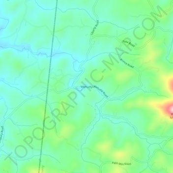
Name: Wehutty topographic map, elevation, terrain.
Location: Wehutty, Cherokee County, North Carolina, United States (35.07397 -84.31714 35.11397 -84.27714)
Average elevation: 529 m
Minimum elevation: 472 m
Maximum elevation: 693 m
Thank you for supporting this site ❤️
Make a donation
Make a donation
Other topographic maps
Click on a map to view its topography, its elevation and its terrain.