
Thank you for supporting this site ❤️
Make a donation
Make a donation
Heimgarten topographic map
Click on the map to display elevation.
Thank you for supporting this site ❤️
Make a donation
Make a donation
Heimgarten
Heimgarten (elevation 1,790 metres/5,870 ft) is a mountain near Ohlstadt in the Bavarian Prealps of southern Germany. It is connected via a ridge with Herzogstand (1,731 metres/5,679 ft) to the east.
Thank you for supporting this site ❤️
Make a donation
Make a donation
About this map
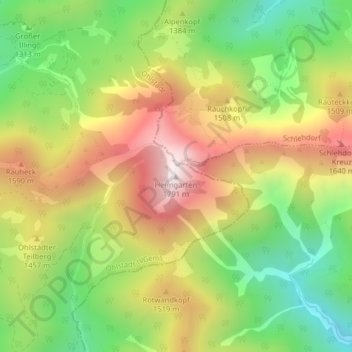
Name: Heimgarten topographic map, elevation, terrain.
Average elevation: 1,342 m
Minimum elevation: 966 m
Maximum elevation: 1,770 m
Thank you for supporting this site ❤️
Make a donation
Make a donation