
Thank you for supporting this site ❤️
Make a donation
Make a donation
Glyn-neath topographic map
Click on the map to display elevation.
Thank you for supporting this site ❤️
Make a donation
Make a donation
About this map
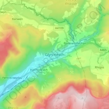
Name: Glyn-neath topographic map, elevation, terrain.
Location: Glyn-neath, Neath Port Talbot, Wales, SA11 5AY, United Kingdom (51.70841 -3.65693 51.78841 -3.57693)
Average elevation: 253 m
Minimum elevation: 26 m
Maximum elevation: 603 m
Thank you for supporting this site ❤️
Make a donation
Make a donation