
Thank you for supporting this site ❤️
Make a donation
Make a donation
McGrady topographic map
Click on the map to display elevation.
Thank you for supporting this site ❤️
Make a donation
Make a donation
About this map
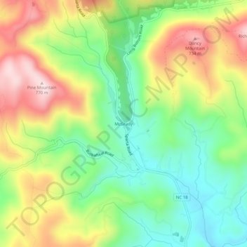
Name: McGrady topographic map, elevation, terrain.
Location: McGrady, Wilkes County, North Carolina, 28649, United States (36.31269 -81.24668 36.35269 -81.20668)
Average elevation: 559 m
Minimum elevation: 406 m
Maximum elevation: 764 m
Thank you for supporting this site ❤️
Make a donation
Make a donation
Other topographic maps
Click on a map to view its topography, its elevation and its terrain.
Rendezvous Mountain State Park
United States > North Carolina > Wilkes County
Average elevation: 541 m
Thank you for supporting this site ❤️
Make a donation
Make a donation
Thank you for supporting this site ❤️
Make a donation
Make a donation