
Thank you for supporting this site ❤️
Make a donation
Make a donation
East Monroe topographic map
Click on the map to display elevation.
Thank you for supporting this site ❤️
Make a donation
Make a donation
About this map
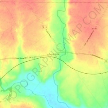
Name: East Monroe topographic map, elevation, terrain.
Location: East Monroe, Highland County, Ohio, 45135, United States (39.33867 -83.51881 39.37867 -83.47881)
Average elevation: 297 m
Minimum elevation: 257 m
Maximum elevation: 322 m
Thank you for supporting this site ❤️
Make a donation
Make a donation
Other topographic maps
Click on a map to view its topography, its elevation and its terrain.