
Thank you for supporting this site ❤️
Make a donation
Make a donation
Daytuli topographic map
Click on the map to display elevation.
Thank you for supporting this site ❤️
Make a donation
Make a donation
About this map
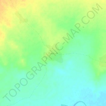
Name: Daytuli topographic map, elevation, terrain.
Location: Daytuli, Liben, Somali Region, Ethiopia (3.98353 41.60525 4.02353 41.64525)
Average elevation: 234 m
Minimum elevation: 221 m
Maximum elevation: 249 m
Thank you for supporting this site ❤️
Make a donation
Make a donation
Other topographic maps
Click on a map to view its topography, its elevation and its terrain.