
Gokyo Ri topographic map
Interactive map
Click on the map to display elevation.
About this map
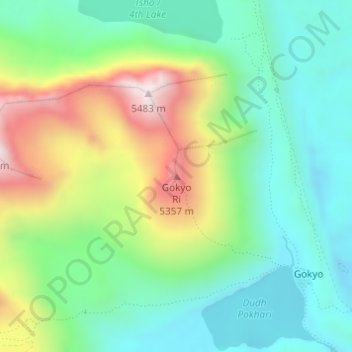
Name: Gokyo Ri topographic map, elevation, terrain.
Location: Gokyo Ri, Khumbupasanglahmu, Solukhumbu, Koshi Province, Nepal (27.96149 86.68308 27.96159 86.68318)
Average elevation: 4,968 m
Minimum elevation: 4,722 m
Maximum elevation: 5,461 m