
Thank you for supporting this site ❤️
Make a donation
Make a donation
Philpott topographic map
Click on the map to display elevation.
Thank you for supporting this site ❤️
Make a donation
Make a donation
About this map
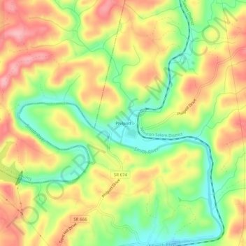
Name: Philpott topographic map, elevation, terrain.
Location: Philpott, Henry County, Virginia, 02405, United States (36.77042 -80.02615 36.81042 -79.98615)
Average elevation: 299 m
Minimum elevation: 227 m
Maximum elevation: 367 m
Thank you for supporting this site ❤️
Make a donation
Make a donation
Other topographic maps
Click on a map to view its topography, its elevation and its terrain.