
Thank you for supporting this site ❤️
Make a donation
Make a donation
Adipala topographic map
Click on the map to display elevation.
Thank you for supporting this site ❤️
Make a donation
Make a donation
About this map
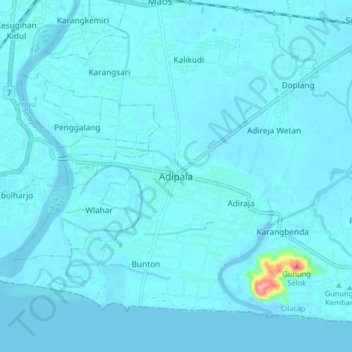
Name: Adipala topographic map, elevation, terrain.
Location: Adipala, Cilacap, Central Java, Java, 53271, Indonesia (-7.69993 109.11146 -7.61993 109.19146)
Average elevation: 6 m
Minimum elevation: -4 m
Maximum elevation: 122 m
Thank you for supporting this site ❤️
Make a donation
Make a donation
Other topographic maps
Click on a map to view its topography, its elevation and its terrain.
Thank you for supporting this site ❤️
Make a donation
Make a donation
Thank you for supporting this site ❤️
Make a donation
Make a donation