
Thank you for supporting this site ❤️
Make a donation
Make a donation
Posong topographic map
Click on the map to display elevation.
Thank you for supporting this site ❤️
Make a donation
Make a donation
About this map
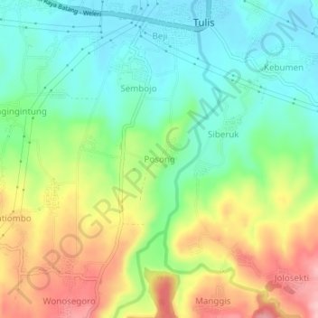
Name: Posong topographic map, elevation, terrain.
Location: Posong, Batang, Central Java, Java, Indonesia (-6.98901 109.78223 -6.94901 109.82223)
Average elevation: 125 m
Minimum elevation: 62 m
Maximum elevation: 227 m
Thank you for supporting this site ❤️
Make a donation
Make a donation
Other topographic maps
Click on a map to view its topography, its elevation and its terrain.