
Redu topographic map
Interactive map
Click on the map to display elevation.
About this map
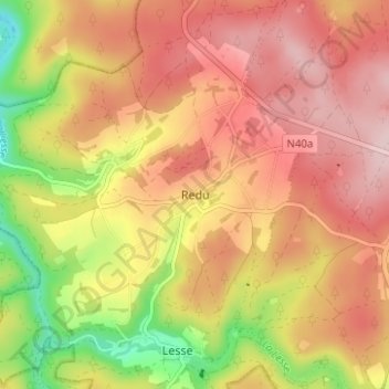
Name: Redu topographic map, elevation, terrain.
Location: Redu, Luxemburg, Wallonië, België (49.98779 5.14018 50.02779 5.18018)
Average elevation: 365 m
Minimum elevation: 227 m
Maximum elevation: 457 m