
Thank you for supporting this site ❤️
Make a donation
Make a donation
Thung Wa topographic map
Click on the map to display elevation.
Thank you for supporting this site ❤️
Make a donation
Make a donation
About this map
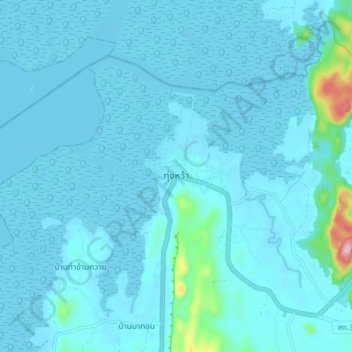
Name: Thung Wa topographic map, elevation, terrain.
Location: Thung Wa, Thung Wa District, Satun Province, Thailand (7.06448 99.71486 7.14448 99.79486)
Average elevation: 22 m
Minimum elevation: 0 m
Maximum elevation: 320 m
Thank you for supporting this site ❤️
Make a donation
Make a donation