
Thank you for supporting this site ❤️
Make a donation
Make a donation
Carver topographic map
Click on the map to display elevation.
Thank you for supporting this site ❤️
Make a donation
Make a donation
About this map
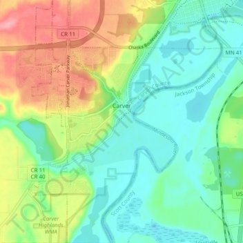
Name: Carver topographic map, elevation, terrain.
Location: Carver, Carver County, Minnesota, 55315, United States (44.73287 -93.65505 44.78696 -93.59421)
Average elevation: 243 m
Minimum elevation: 208 m
Maximum elevation: 311 m
Thank you for supporting this site ❤️
Make a donation
Make a donation
Other topographic maps
Click on a map to view its topography, its elevation and its terrain.
Thank you for supporting this site ❤️
Make a donation
Make a donation
New Germany
United States > Minnesota > Carver County > New Germany > New Germany
Average elevation: 298 m