
Thank you for supporting this site ❤️
Make a donation
Make a donation
Sherwood topographic map
Click on the map to display elevation.
Thank you for supporting this site ❤️
Make a donation
Make a donation
About this map
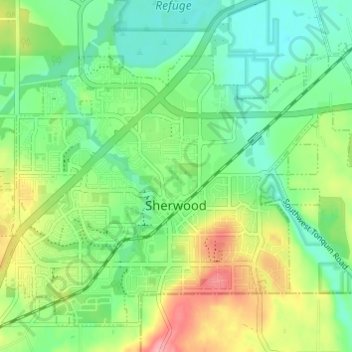
Name: Sherwood topographic map, elevation, terrain.
Location: Sherwood, Washington County, Oregon, 97140, United States (45.34235 -122.87503 45.37516 -122.80545)
Average elevation: 68 m
Minimum elevation: 29 m
Maximum elevation: 182 m
Thank you for supporting this site ❤️
Make a donation
Make a donation