
Thank you for supporting this site ❤️
Make a donation
Make a donation
Ramseytown topographic map
Click on the map to display elevation.
Thank you for supporting this site ❤️
Make a donation
Make a donation
About this map
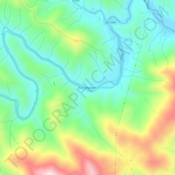
Name: Ramseytown topographic map, elevation, terrain.
Location: Ramseytown, Yancey County, North Carolina, United States (35.98067 -82.37735 36.02067 -82.33735)
Average elevation: 819 m
Minimum elevation: 628 m
Maximum elevation: 1,202 m
Thank you for supporting this site ❤️
Make a donation
Make a donation
Other topographic maps
Click on a map to view its topography, its elevation and its terrain.