
Thank you for supporting this site ❤️
Make a donation
Make a donation
Mount Vision topographic map
Click on the map to display elevation.
Thank you for supporting this site ❤️
Make a donation
Make a donation
About this map
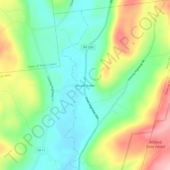
Name: Mount Vision topographic map, elevation, terrain.
Average elevation: 415 m
Minimum elevation: 344 m
Maximum elevation: 533 m
Thank you for supporting this site ❤️
Make a donation
Make a donation
Other topographic maps
Click on a map to view its topography, its elevation and its terrain.
Thank you for supporting this site ❤️
Make a donation
Make a donation
Maryland
United States > New York > Otsego County > Town of Maryland > Maryland
Average elevation: 464 m
Thank you for supporting this site ❤️
Make a donation
Make a donation